CompassTrac® Enterprise

Real-Time Mobile Asset Location Software
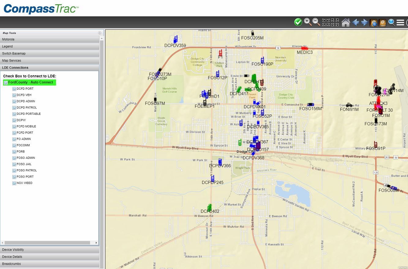
Track your mobile assets' locations, status and messaging in real-time with ArcGIS map data to empower operational excellence.
Description
CompassTrac® is an on-premise mobile resource management (AVL) platform that provides real-time location, status and messaging for mobile assets leveraging ASTRO® 25 or MOTOTRBO™ wireless networks. Data is displayed in real-time on a mapping app fully integrated with your ArcGIS™ data and viewed by desktop, laptop, tablet or smartphone users. Our CompassLDE server manages the data flowing from Motorola, cellular or IoT networks to insure interoperability across the enterprise. Data is archived in a SQL Standard database for replay or analytics with the CompassReports™ app.

Additional Resources
Industry
Commanders and operational managers make decisions based on real-time data, tailored to the user’s workflow to enable operational excellence. CompassTrac support full interoperability for multiple wireless networks and mobile IoT (sensors) viewed in a GIS common operational picture to sharing of data across the multiple agencies.
Users benefits:
• Increases command and control
• Monitors employee and contractor performance
• Increases fleet efficiency and reduces costs
• Dispatching of vehicles to job and/or incidents based on their true location and status
• Increases driver safety
• Reduces response times
• Utilizes current investment in ArcGIS data
ASTRO, MOTOTRBO & LTE/4G device with GPS
Minimum Windows 2012 R2, Hard Drive 300GB, SQL Server Standard 2014, RAM 16 GB, Processor Speed Dual 2.8 Ghz
Recommended: Windows 2016, 1TB drives in RAID Array, 8 Core, 32 GB RAM, SQL Standard 2017
Connections to IMW with trunked system, connection to IPX radio for conventional system. LAN Speed 10/100mbps
Browser based system works with connection to the internet or disconnected inside customers firewall for high security requirements. Leverage customers ArcGIS server data, leverage ArcGIS Online data for configurable map background.
Location and messaging data is archived in a SQL database for after action review with replay and analytics with CompassReports®.
Standard API available for integration of real-time data into 3rd party applications such as CAD and Asset Management applications.
ASTRO, MOTOTRBO & LTE/4G device with GPS
Minimum Windows 2012 R2, Hard Drive 300GB, SQL Server Standard 2014, RAM 16 GB, Processor Speed Dual 2.8 Ghz
Recommended: Windows 2016, 1TB drives in RAID Array, 8 Core, 32 GB RAM, SQL Standard 2017
Connections to IMW with trunked system, connection to APX radio for conventional system. LAN Speed 10/100mbps
Browser based system works with connection to the internet or disconnected inside customers firewall for high security requirements. Leverage customers ArcGIS server data, leverage ArcGIS Online data for configurable map background.
System Architecture
Compatible with IP Site Connect, Capacity Plus, Linked Capacity Plus, Connect Plus, Capacity Max, ASTRO M- Core, ASTRO L-Core, ASTRO K-Core and Intelligent Middleware.
Other Requirements
SQL Standard license required for deployment. Disconnected systems for high security integrations require GIS data on-premise for map support. May require additional purchase from map vendor. Support for IA government and defense deployments