DMRAlert Street

Enhanced GPS tracking solution
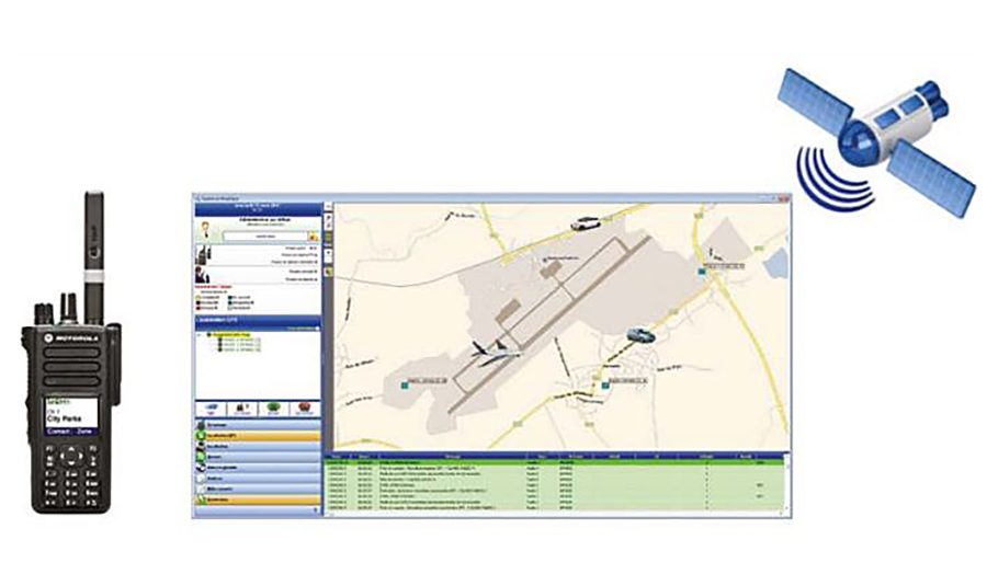
Dmralertr Street is a Management Tool allowing Users to track Gps enabled Mototrbo Radio fleet Throughout a Designated area Down to street Level.
Description
DMRAlert® STREET is a fleet management and location tracking application ensuring security for outdoor fleet. It allows users to track GPS enabled MOTOTRBO radio fleet throughout a designated area down to street level. The event log will detail the street names allowing quick reference and easier identification of the users location. The application uses OpenStreet Map to display the GPS locations.
DMRAlert® STREET facilitates the management of teams, groups, agents or vehicles. Users are immediately notified in emergency situations which, as a result, speed up the response time.
With also the possibility to create activity reports, DMRAlert®STREET is particularly well suited for Police Forces, Transportation or Hospitality,',thanks to features like geofencing, area management, URL transmission to smartphone, text-to-speech-to-phone sets transmission, escalation, etc.
Industry
• GPS location tracking of MOTOTRBO radios.
• Emergency and Alarm Management; sound and visual alerts, notification reports.
• Easy creation of detailed reports down to street addresses and the address nearest to the person and vehicles, search/management by areas.
• Mappoint, Raster, WGS84, Google™ , OSM™, IGN.
• SMS messages.
• Voice recording
• Emergency calls to radio, phone sets, smartphones, SMS, email, dry contact, etc.
• Full history of the events.
• Access rights management.
• Automatic management of radio fleet and groups.
• Client / Server solution.
• Remote activation / deactivation and listening.
• Email to radio SMS, personalised reports, telemetry.
Radio Hardware / Releases Compatibility
MOTOTRBO.
Computer Hardware / Operating Systems
PC Windows Seven Pro, IP, USBs, sound.
MOTOTRBO System Architecture
Conventional, IPSC, CAPACITY+, LCP, NAI Data, CSBK and Single CSBK.