NEW IN COMMANDCENTRAL Aware - Q2 2024
We're excited to review the work done this past quarter to improve the CommandCentral Aware experience for users. For any questions, please contact customer success.
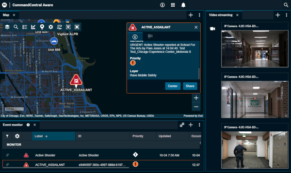
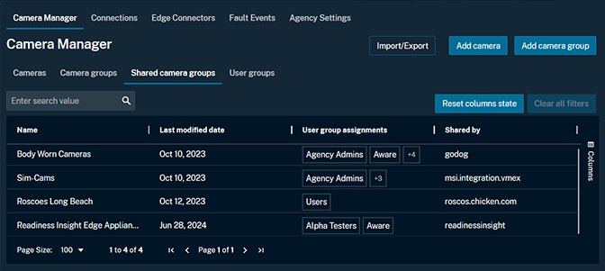
Share your common operating picture
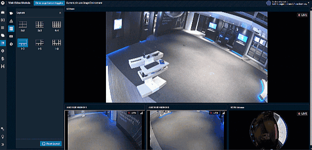
Access and view livestreams simultaneously with your partner CommandCentral Aware agencies while working together on an incident response. Agencies with a Memorandum of Understanding (MOU) in place can share groups of cameras in order to have simultaneous access to the cameras within those camera groups.
Administrators are able to share camera groups based on Agency ID (provided by the sharing agency) and make the appropriate cameras available to user groups in CommandCentral Aware. Groups are able to be shared on a temporary basis, and access to camera groups can be removed at any time. The agency receiving access will have access to the cameras in livestream only mode. The sharing agency has complete control of the cameras’ functionality, recording and access to export.
Read more: 7-11-2024 release notes
Enhanced video connections to Verkada and Milestone XProtect
A new enhanced experience for cloud-based provisioning and livestreaming is now available for Verkada and Milestone XProtect video management systems (VMS). Agencies can extend their video footprint by connecting to agency and partner-owned cameras. This new, enhanced experience allows agencies to further expand their coverage by securely accessing video from community partners, such as businesses, schools and places of worship using these VMS.
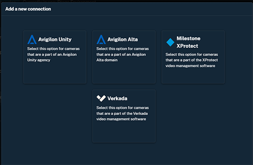
Look for additional VMS integrations coming soon. Speak with your account representative to learn more.
Read more: 5-17-2024 release notes
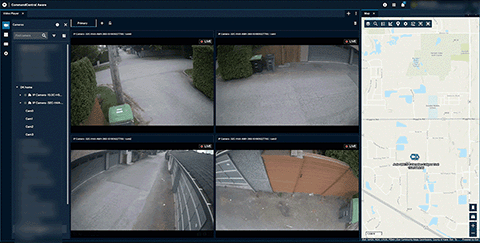
Enhancements for edge appliance: Video playback and Fault Events
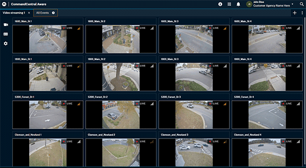
An edge appliance allows your agency to securely access live video from community partners, connecting up to 30 IP security cameras on a network to your public safety command center.
Video recording and playback of two days for cameras connected through an edge appliance is now available, giving your agency more time to capture images for further investigation.
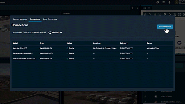
Your agency can now also view, investigate and resolve any errors that may occur while discovering cameras connected with an edge appliance. The Fault Events tab in the web video player Camera Manager surfaces any connection errors and provides a description to resolve the error. Search and filter to more easily find and resolve connection errors.
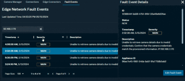
NOTE: Cameras connected with an edge appliance must support ONVIF Profile S for automatic discovery and configuration. RTSP streams can be consumed as well via manual configuration.
Read more: 5-17-2024 release notes
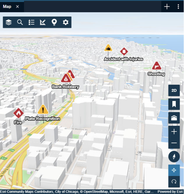
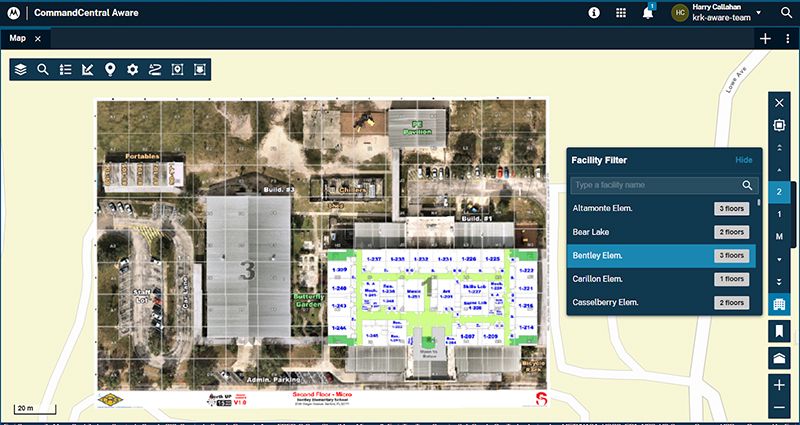
Critical Response Group (CRG) floor plan integration
Floor plans provide operators with situational awareness of a building layout, such as ingress/ egresses or room locations, in order to provide better information to responders.
Administers can now add Critical Response Group (CRG) floor plans to CommandCentral Aware by creating WMS Floor Plan layers in the Universal Web Map from CommandCentral Admin 2.0.
When CRG floor plan layers are enabled in the Map View module, the buildings and floors become available in the Facility Filter dialog box.
Read more: 06-05-2024 release notes
Magnify image attachments (2X)
An operator can now more clearly view image details, such as a license plate image, by magnifying image attachments on the Attachments tab in the Event Details window. The image size can be increased by a factor of two by clicking the magnification (loop) icon.

Read more: 5-17-2024 release notes