
Overview
Safer Cities. Thriving Communities.
First responders can be in danger at any moment of the day. Whatever the situation, public safety operations depend on immediate access to the most accurate information available.
PremierOne CAD is transforming public safety and dispatch operations. It streamlines the capture, correlation and real-time distribution of mission critical information for improved dispatch decision making and increased responder awareness and safety.
Features
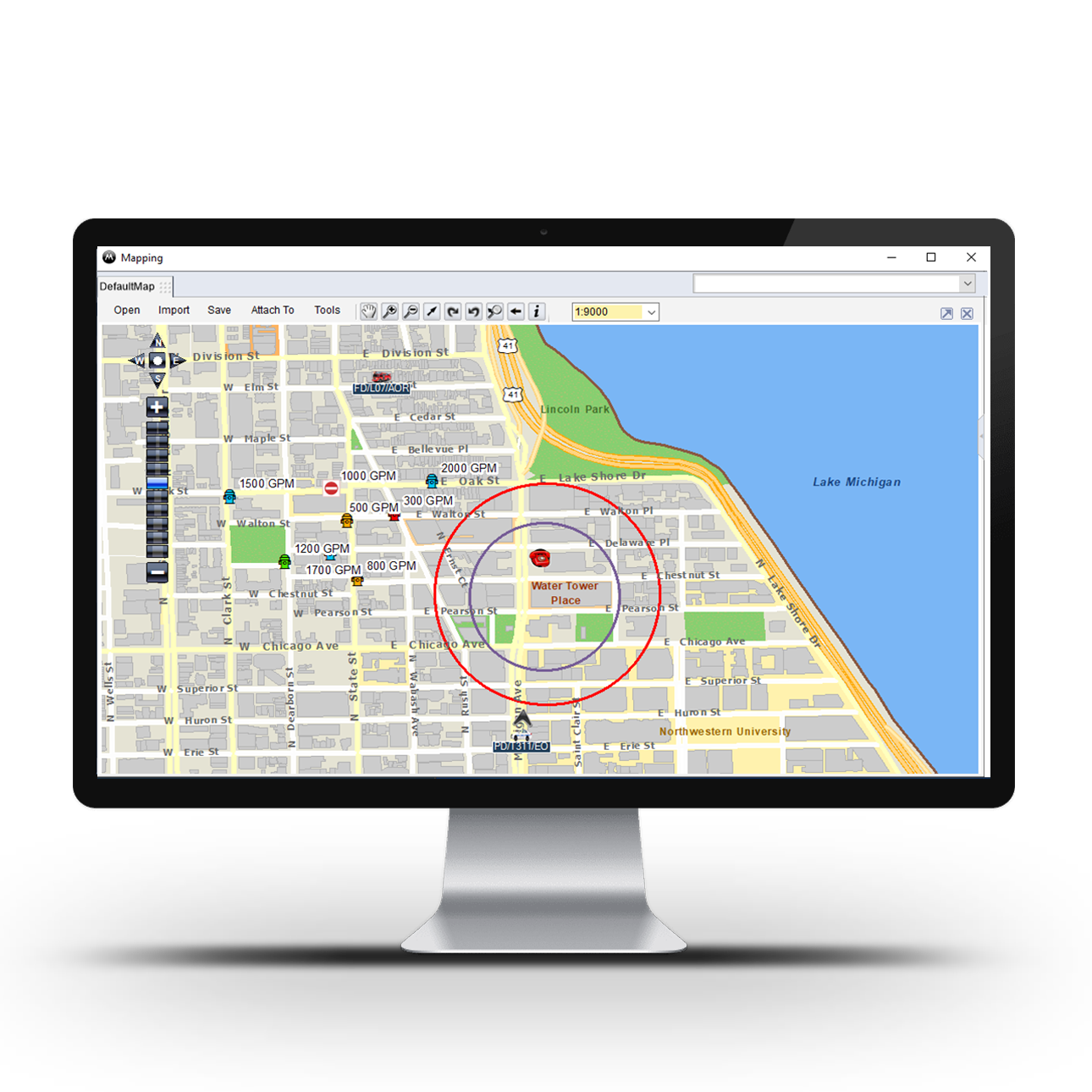
Quickly locate responders on your CAD map

Improve efficiency with integrated call control
Improve agency security
Integrate on-premises deployments with RapidSOS
Appropriately allocate unit resources
Easily run system and dispatch reports
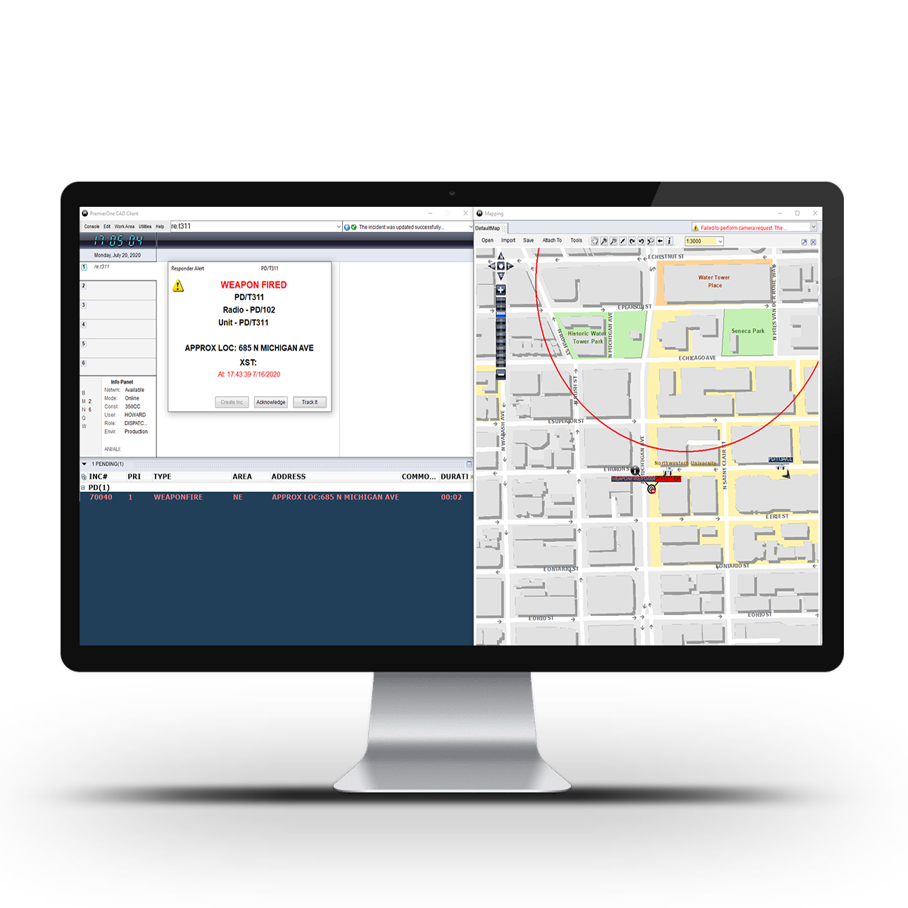
Improve responder safety through responder alerts
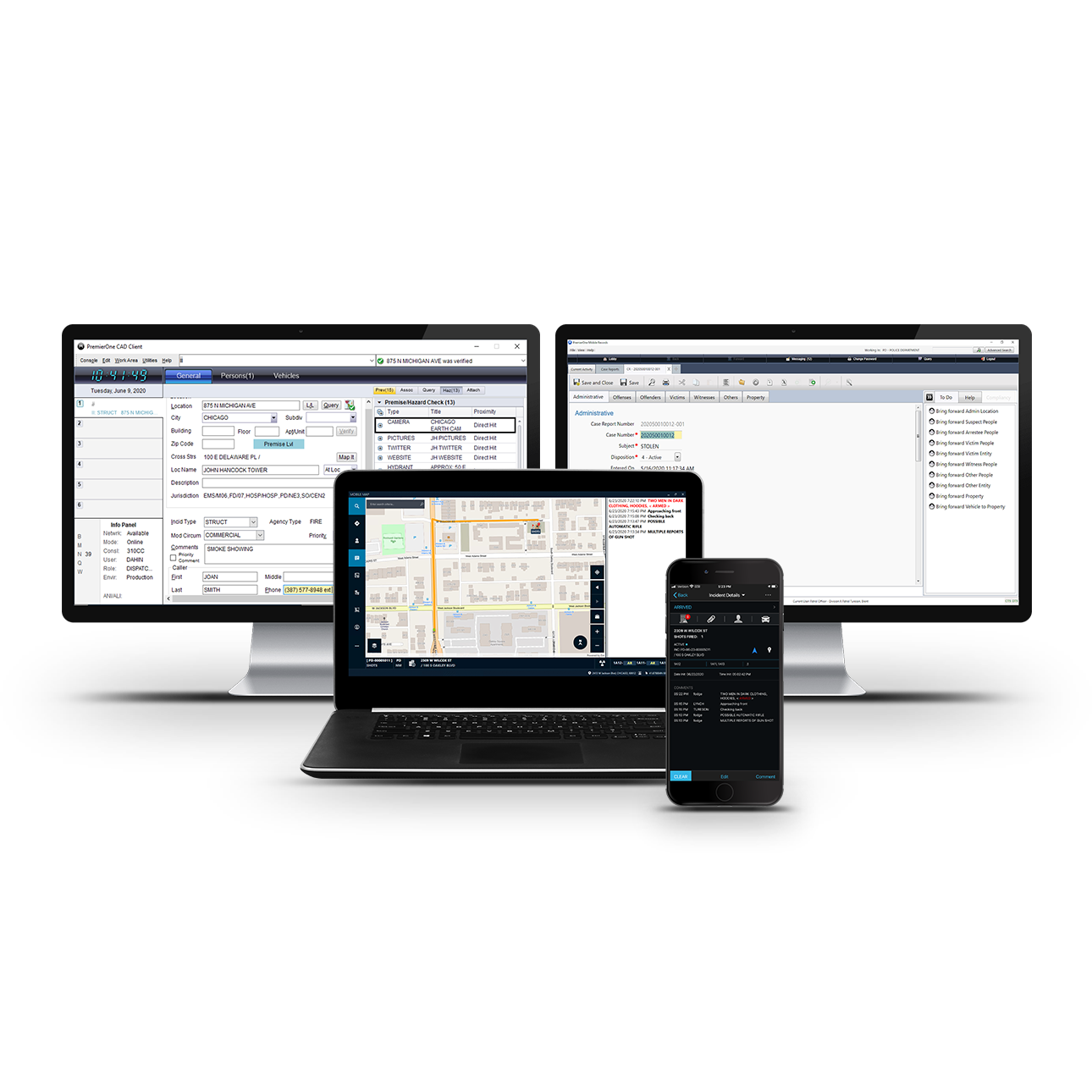
Seamless mobile connection to field responders
Key capabilities
Dispatch the Right Resources with Confidence
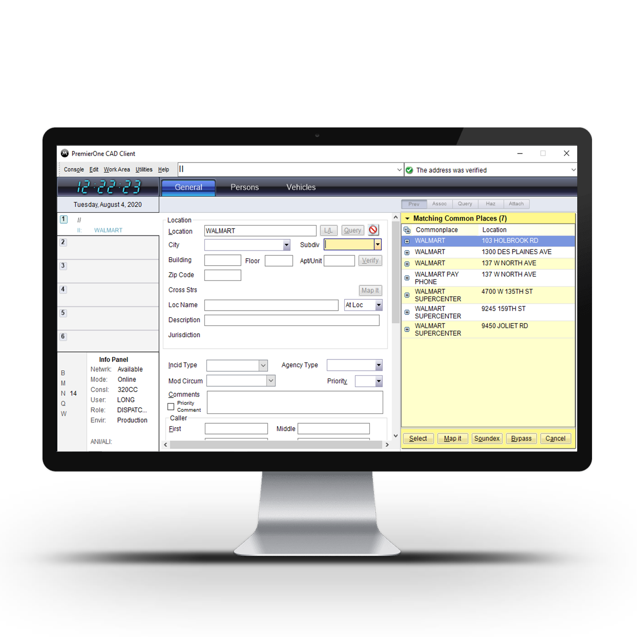
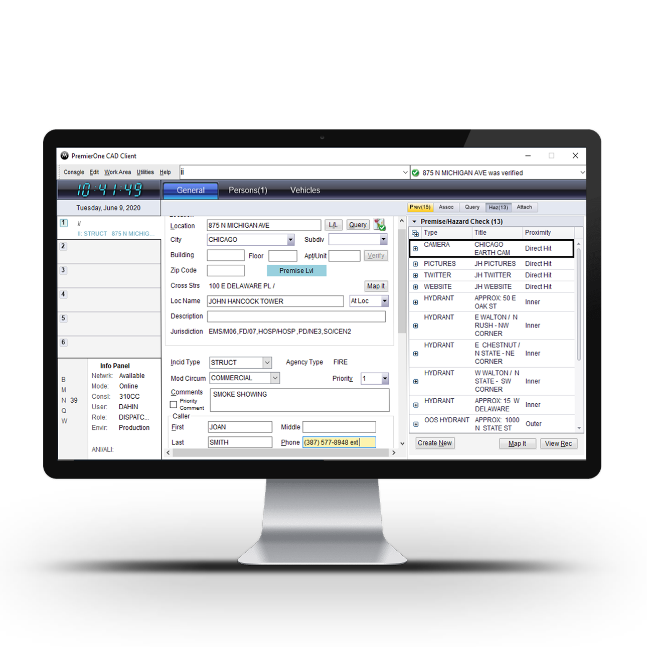
PremierOne CAD software allows dispatchers to access complete data on every situation including the incoming call, related records and responder location and status. With access to all critical information, you can help support a safer and more prepared response. PremierOne CAD software helps improve your team’s response times, efficiently allocate resources and better inform first responders through greater information gathering and situational awareness.
Strengthen Situational Awareness
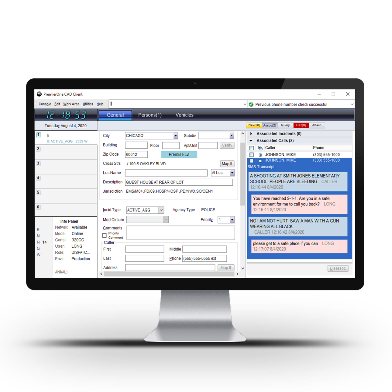
Access previous incidents and current information relating to the location, situation and caller without disrupting natural dispatch workflow. Dispatchers are able to provide field responders with complete information including who they are dealing with as well as how to prepare and respond for the best results.
Improve Responder Safety
Enhance your dispatch workflow with integrated access to quickly and accurately determine current responder location and status while also maintaining communication in the field. Send critical information to responders with CAD-to-radio messaging and promptly request backup from nearby units with emergency button activation and console integration, providing accurate responder location.
Speed Response by Minimizing Data Entry
Provide a seamless flow of essential information in to the dispatcher and out to first responders in order to minimize points of data entry. This allows for a faster, clearer workflow that’s necessary for keeping both your officers and civilians safe.
Integrated apps
Featured solutions

CommandCentral Aware
Gain a complete operating picture, integrating real-time intelligence in the command center to remotely assist officers in the field. Simplify your operational view into one single pane of glass and support officer safety by monitoring real-time alerts and video feeds for evolving incidents.


Resources
Product information