In 1991, the ASTRO system was born. With the anticipation of Project 25 (P25) – designed to create a user-driven, flexible, and open standard for radio communications – Motorola Solutions built ASTRO as a land mobile radio (LMR) platform to comply with the P25 standard. To celebrate ASTRO’s 25th year, this series will look at the past, present, and future of ASTRO 25 and answer the most pressing questions being asked by radio users today.
If you use location-based services with geofencing on your land-mobile radio (LMR) network, you understand the operational efficiencies and personnel safety that these solutions provide. The ability to see where your resources are located improves your situational awareness keeping your response times short and allowing you to quickly send backup when needed. A circle drawn on a map screen creates a virtual boundary which triggers an icon color change and a pop-up message when field personnel enter or exit an incident scene. But, what if your geofence could put your radio in control…
Putting The Radio In Control
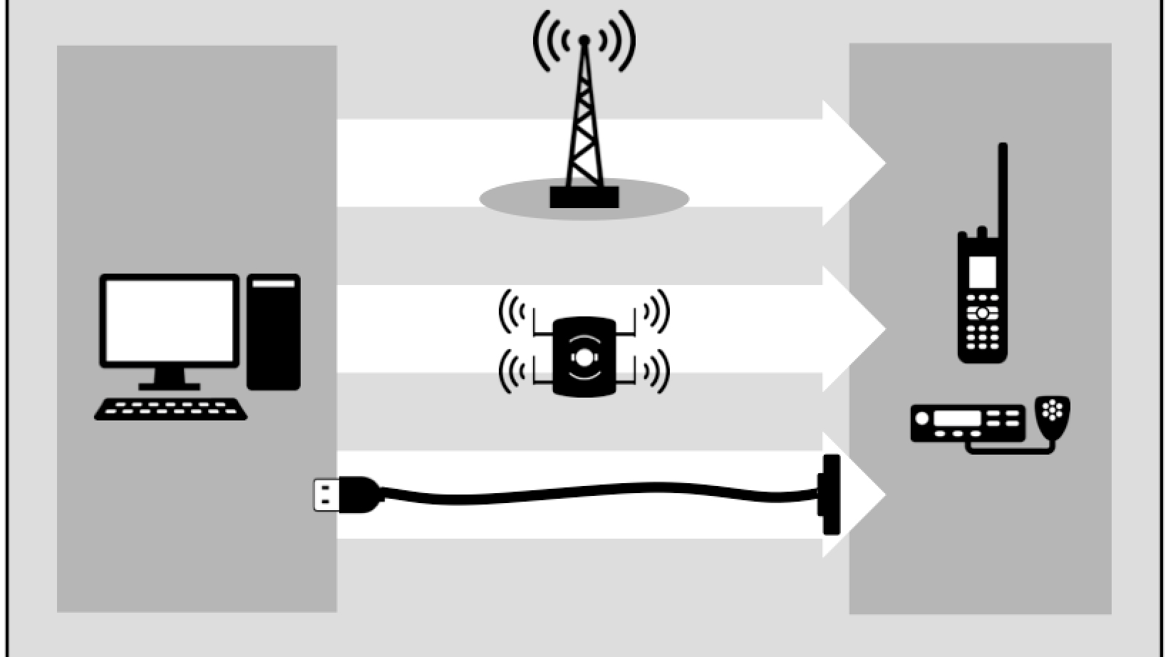
The next evolution of public safety geofence puts the intelligence into your LMR radio with dynamic and permanent virtual geographic boundaries. Dynamic geofences, with incident-specific radio actions are created in a mapping application by a dispatcher and then pushed over the ASTRO 25 network into APX two-way radios. Permanent geofences can be programmed directly into the radio with customer programming software (CPS).
Because the geofences are stored in the radio, the radio immediately knows when it crosses a geographic boundary, even when off the ASTRO® 25network. Upon crossing a geographic boundary, the radio will automatically execute the pre-programmed radio actions for that geofence, such as changing talkgroups, alerting the radio user and updating dispatch. This autonomous operation provides hands-free operation for first responders during a critical emergency situation.
How Could You Use This?
Let’s consider an emergency situation in which a dynamic geofence is needed. The dispatcher creates a boundary around the incident and selects first responders for the geofence. As the first responders enter the incident area, their radios immediately change to the incident channel or talkgroup, providing hands-free operation. Dispatch communications is minimized since the radio visually and audibly announces to the radio user they have entered the incident area. This solves one of the most common problems of incident management, ensuring all first responders are on the correct radio channel so they communicate with each other. When the incident is over, dispatch takes down the geofence and all radios go back to their previous settings.
Now let’s consider when a permanent geographic boundary would be utilized in daily operations, such as communications with campus university emergency services. A geofence with preprogrammed radio actions is created for the university and loaded into the radio. Upon entry to the campus, the first responder’s radio switches to the campus radio channel, lowers its power level and sends a message to dispatch that the user’s radio has changed channels. All this is done automatically, without the responder having to remember the campus radio channel and without having to call dispatch.
In both examples, the geofence intelligence is in the APX radio. This means the radio can take immediate action, even when in a poor coverage area and completely disconnected from the network. Automatic and hands-free operations ensure immediate communications on the correct radio channel.
Learn more about the Motorola Solutions ASTRO 25 Network.